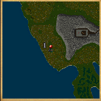
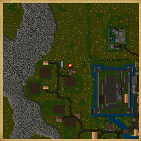
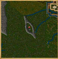
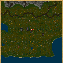
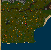
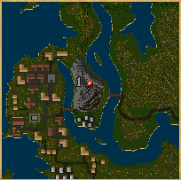
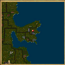
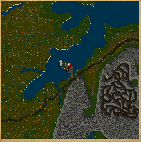
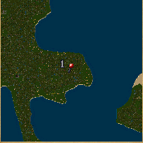
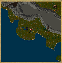
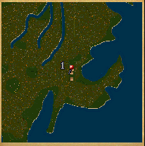
![map-bridgekings](http://uo.com/wp-content/uploads/2015/09/map-bridgekings.gif)
The Bridge of Two Kings west of Dungeon Destard.
91o40′ S, 22o4′ W) |
![map-britainfarm](http://uo.com/wp-content/uploads/2015/09/map-britainfarm.gif)
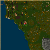
A farmhouse west of Lord British’s Castle.
(4o34′ N, 6o40′ W) |
![map-destardcave](http://uo.com/wp-content/uploads/2015/09/map-destardcave.gif)
A small cave east of Dungeon Destard.
(96o35′ S, 3o1′ E) |
![map-hiddenvalley](http://uo.com/wp-content/uploads/2015/09/map-hiddenvalley.gif)
The mage tower in Hidden Valley west of Trinsic
(119o37′ S, 24o45′ E |
![map-honorruin](http://uo.com/wp-content/uploads/2015/09/map-honorruin.gif)
The ruins northwest of the Honor Shrine.
(153o37′ S, 20o6′ E) |
![map-jhelomfarm](http://uo.com/wp-content/uploads/2015/09/map-jhelomfarm.gif)
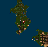
The stable of the eastern farm on the north Jhelom Island.
(173o19′ S, 10o41′ W) |
![map-coveruin](http://uo.com/wp-content/uploads/2015/09/map-coveruin.gif)
The ruins south of Dungeon Covetous.
(45o52′ E, 83o40′ E) |
![map-vesperruin](http://uo.com/wp-content/uploads/2015/09/map-vesperruin.gif)
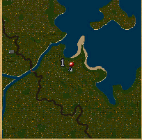
The ruins west of Vesper.
(44o28′ N, 88o31′ E) |
![map-minocmine](http://uo.com/wp-content/uploads/2015/09/map-minocmine.gif)
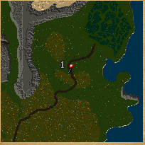
The mines east of Minoc.
(101o51′ N, 88o56′ E) |
![map-moonglow](http://uo.com/wp-content/uploads/2015/09/map-moonglow.gif)
The house south of the telescope at Moonglow.
(39o6′ N, 123o33′ W) |
![map-skarafield](http://uo.com/wp-content/uploads/2015/09/map-skarafield.gif)
A field at the farms southeast of Skara Brae.
(69o20′ S, 30o9′ W) |
![map-spiritruin](http://uo.com/wp-content/uploads/2015/09/map-spiritruin.gif)
The ruins west of the Shrine of Spirituality.
(77o41′ S, 10o20′ E) |
![map-spirittent](http://uo.com/wp-content/uploads/2015/09/map-spirittent.gif)
A tent north of the Shrine of Spirituality.
(46o45′ S, 18o50′ E) |
![map-swampoutpost](http://uo.com/wp-content/uploads/2015/09/map-swampoutpost.gif)
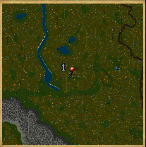
Near the Bog of Desolation northeast of Britain.
(41o55′ N, 42o49′ E) |
![map-yewruin](http://uo.com/wp-content/uploads/2015/09/map-yewruin.gif)
The ruins south of Yew.
(27o35′ N, 53o5′ W) |
![map-guardisle](http://uo.com/wp-content/uploads/2015/09/map-guardisle.gif)
A guard outpost on the road east of Yew.
(66o21′ N, 4o38′ W) |
![](https://uo.com/wp-content/uploads/2015/09/map-jungleruin.gif)
The ruins in the jungle far east of the Honor Shrine.
(153o16′ S, 60o7′ E) |
![map-magincia](http://uo.com/wp-content/uploads/2015/09/map-magincia.gif)
Just north of the fountain in Magincia.
(50o26′ S, 167o24′ E) |
![map-shameruin](http://uo.com/wp-content/uploads/2015/09/map-shameruin.gif)
The ruins west of Dungeon Shame.
(2o38′ S, 59o37′ W) |
![map-trapperhut](http://uo.com/wp-content/uploads/2015/09/map-trapperhut.gif)
The trapper huts south of the Shrine of Sacrifice.
(92o27′ N, 142o6′ E) |